Paparoa Track
Virgin temperate rainforests, tussock mountaintops, pristine rivers, immense limestone cliffs, and crashing oceans. If you seek big country, new wilderness frontiers and untamed trails going guided with Paparoa Guided Walks is the adventure for you.
from $1899PP
Our all-inclusive trip includes
Transport to and from the track, including shuttles from Greymouth.
Three nights’ accommodation in remote, comfortable DOC backcountry huts.
All meals, freshly prepared and carried by the guide, including hearty breakfasts, packed lunches, delicious dinners, and snacks.
Complimentary use of high-quality hiking gear: lightweight down sleeping bag, 40L backpack, and carbon fiber hiking poles.
The expertise and support of a local, knowledgeable, and qualified guide who not only ensures your safety and comfort but also enriches your experience with insights into the flora, fauna, and history of the area.
Personalised care, including consideration of group members’ abilities and pacing, and encouragement throughout the journey—making the walk accessible and enjoyable for a wide range of ages and fitness levels.


Day 1 - Greymouth to Ces Clark Hut
Level of difficulty - Moderate
10.3km, (6.4 miles), 4-5hr
Your adventure will begin with a scenic drive from our base in Greymouth, alongside the Māwhera River to the historic mining town of Blackball. After passing through Blackball, we will continue to the Smoke-ho car park and the beginning of the Paparoa Track.
This first section has been in use for years. Known as the Croesus Track, it gently rises alongside Blackball Creek past gold mining ruins and relics to 16-bunk Ces Clark Hut. The hut is right on the bush edge and has magnificent views of the Grey Valley and the Southern Alps. If time allows, you will take the side track to Garden Gully (45min return) where you can cross a suspension bridge and explore a century-old quartz crushing battery and collapsed mine site. Bikers often miss this hut and continue onto Moonlight Tops Hut.
Day 2 - Ces Clark Hut to Moonlight Tops Hut
Level of difficulty - Easy
9.7km (6 miles), 3-4hr
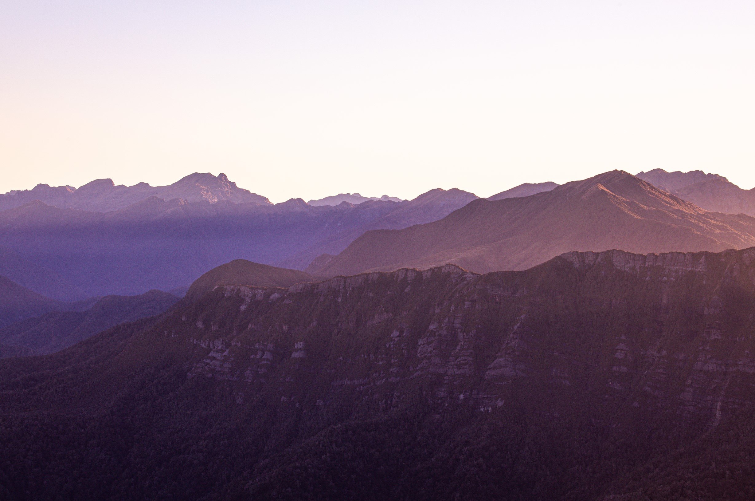
On Day 2 you will be rewarded with expansive views of Grey River/Māwhera to the east and the Tasman Sea to the west. Moonlight Tops Hut provides spectacular views across the Punakaiki River headwaters to the Pike Stream escarpment and north to the Paparoa National Park.
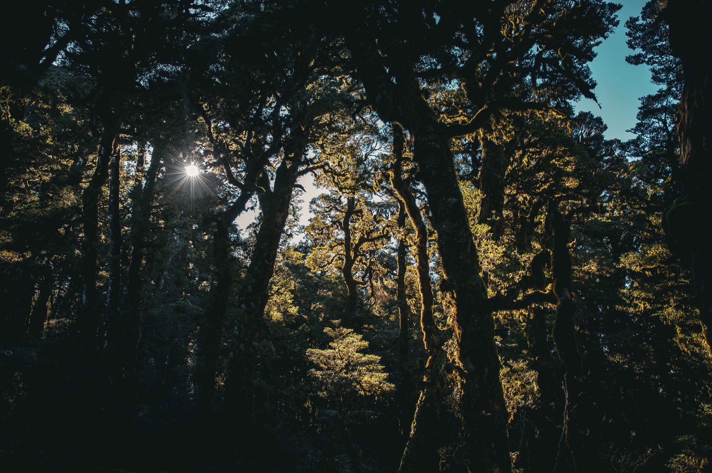
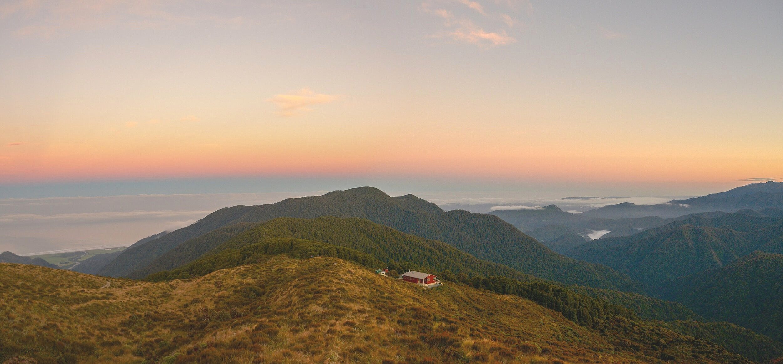
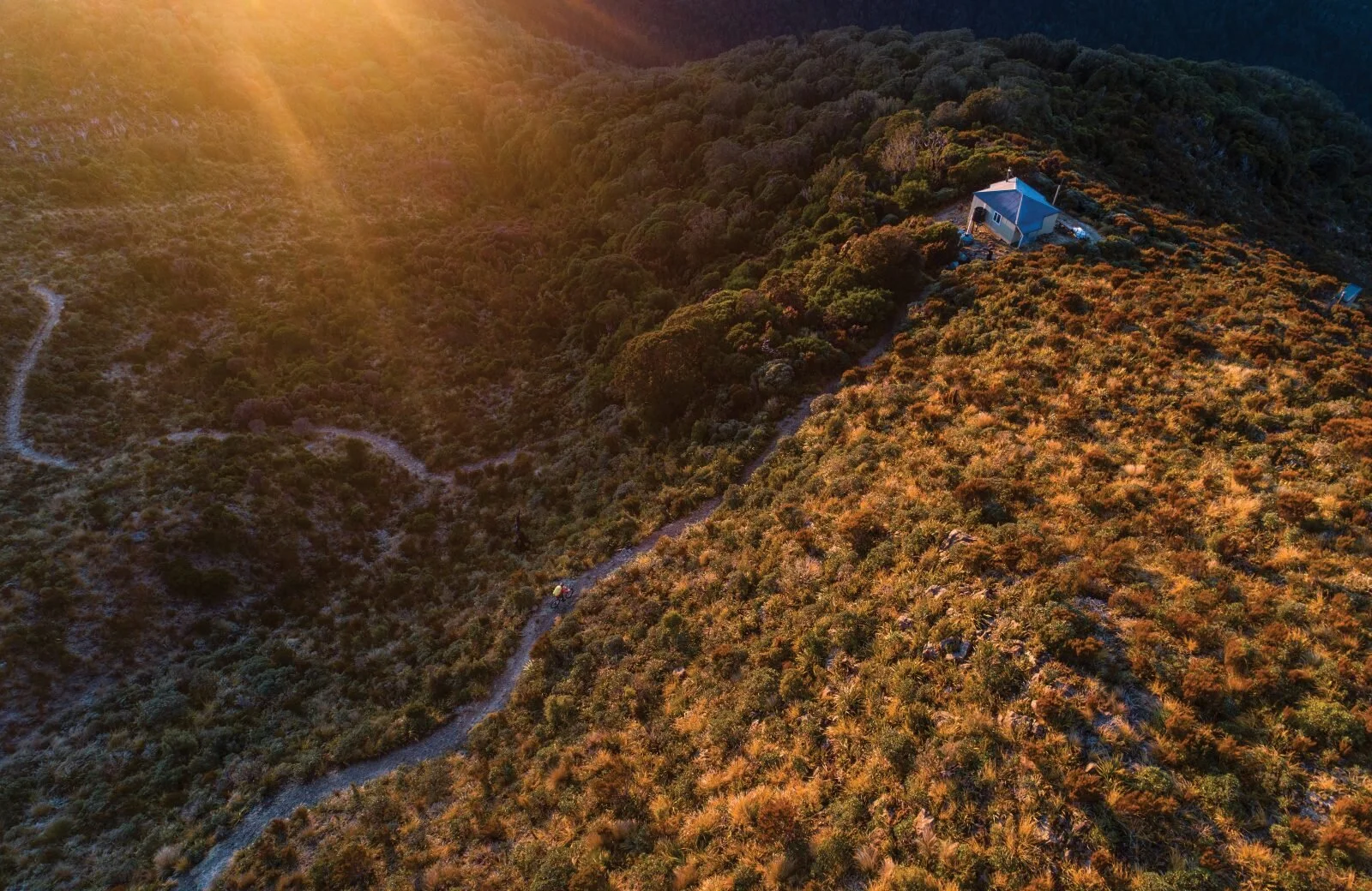
The trail climbs through alpine scrub and tussock to the ridge of the Paparoa Range and follows this north above the Roaring Meg and Moonlight Creek catchments. On a fine day, you’ll have views of Aoraki/Mt Cook, New Zealand’s highest mountain. The 20-bunk Moonlight Tops Hut is at 1000m altitude and high above the treeline making it one of the most spectacular hut locations on the walk.
Day 3 - Moonlight Tops Hut to Pororari Hut
Level of difficulty – Moderate
19.1km (11.8 miles), 6-8hr
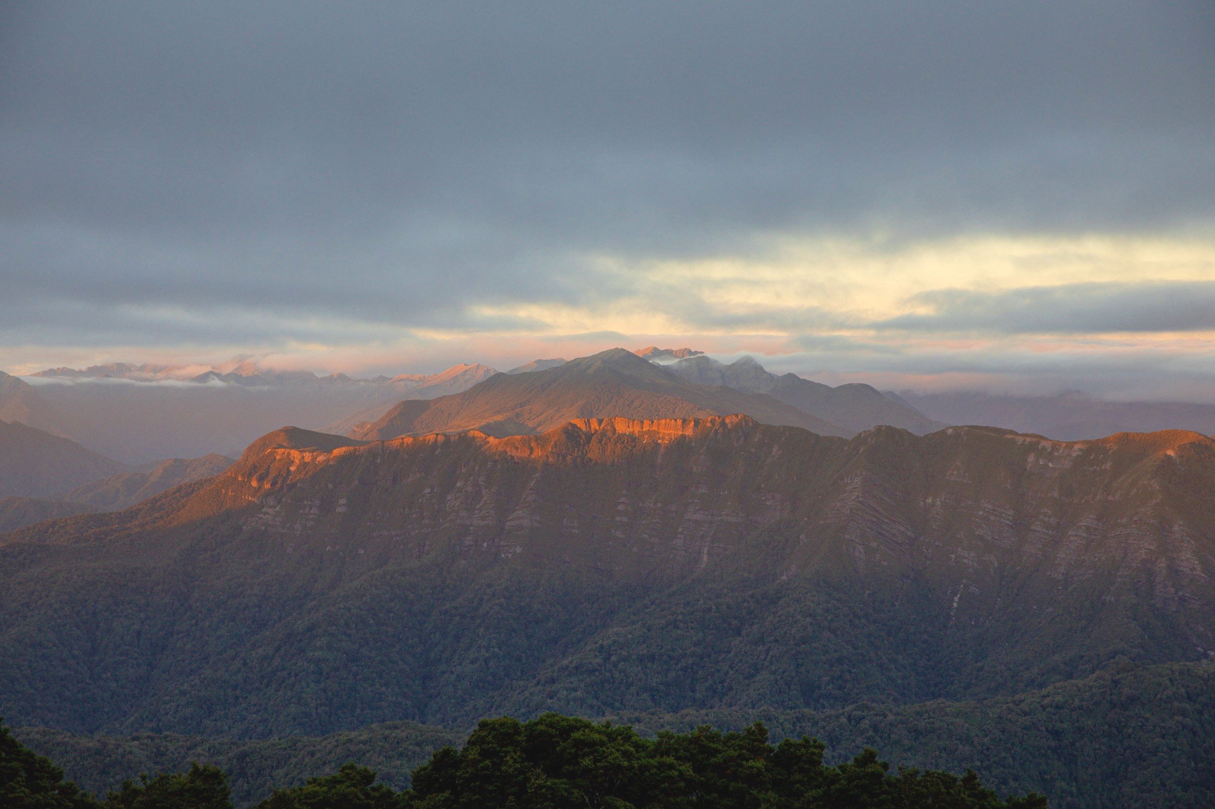
On Day 3, open tops give way to alpine forest stunted by the harsh environment and includes the dramatic escarpment – a gigantic sandstone bluff extending 2km along the main range and towering above the Punakaiki headwaters. Along this section the Paparoa Track winds along the top of the escarpment where the landscape is striking with stunning views down the Pike Stream in the east, stretching west to Punakaiki and north-west to Westport.
About halfway to Pororari Hut, you descend below Mt Hawera from the escarpment to walk through ancient podocarp forest under towering cliffs. The track then follows the spine of the Tindale Ridge to Pororari Hut. As you traverse the ridge, look north to see the Lone Hand (947m), a curious and gnarled outcrop of bedrock on the north side of the Pororari River and sweeping views out to the Tasman Sea. Roroa (great spotted kiwi) are endemic to the South Island and known to inhabit the surrounding bush, often heard at night. Be sure to have a red light on your headtorch for your best chance to see them!
Day 4 - Pororari Hut to Greymouth
Level of difficulty – Moderate
16km, (10 miles) 5-6hr
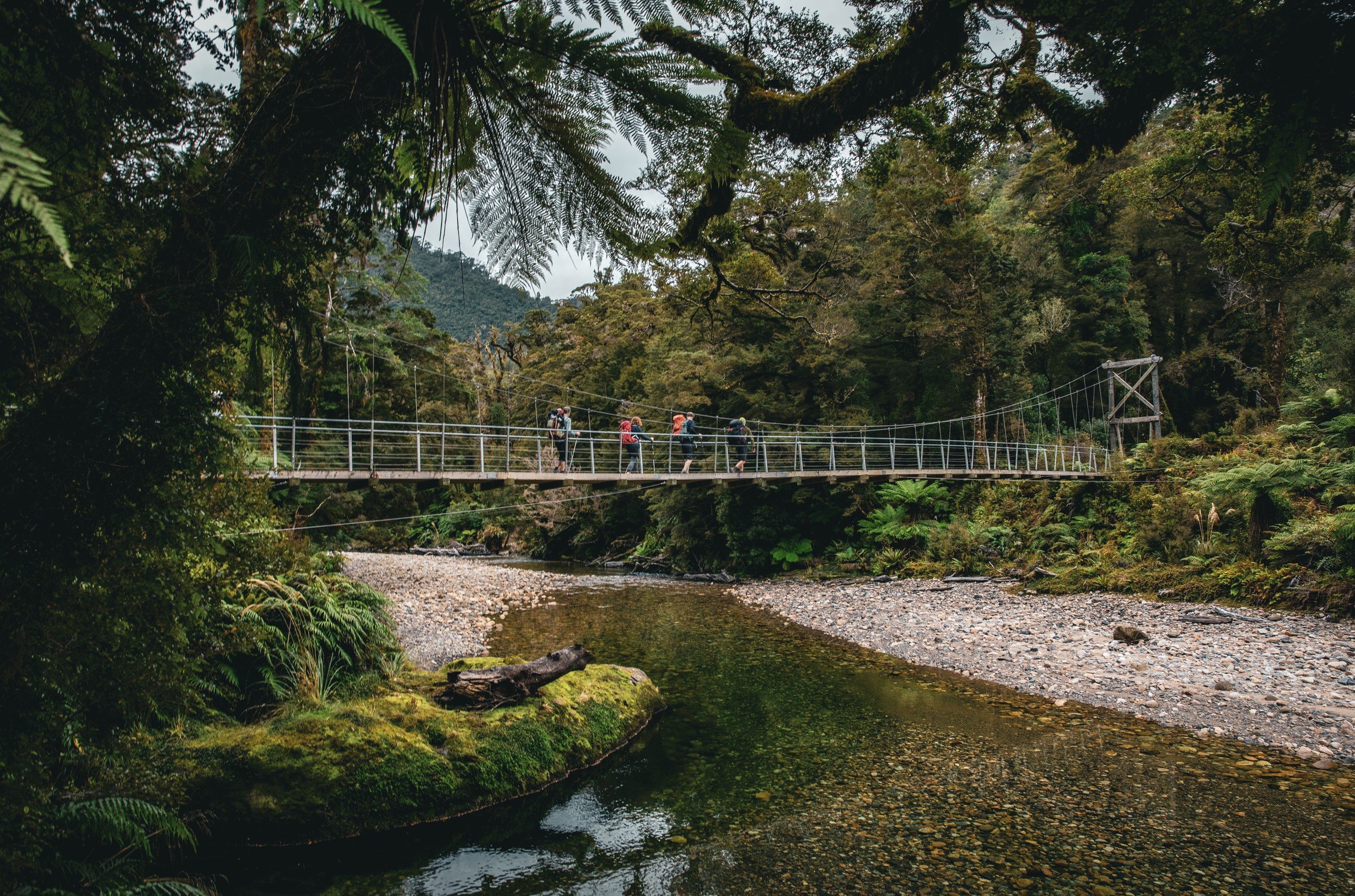
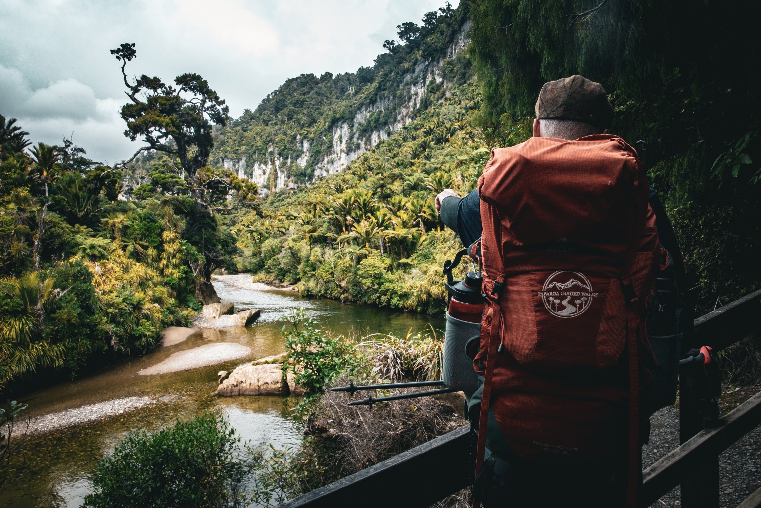
The Paparoa Track then descends down the upper Pororari River valley until joining an old pack track built to establish settlement in the upper valley. The track then sidles a spectacular gorge and descends towards the coast through beech forest interspersed with northern rātā. From here you will catch glimpses of the lower Pororari River.
At the junction with the historic Inland Pack Track, walkers and mountain bikers diverge: walkers follow the Pororari River Track which sidles the lower gorge with its striking limestone cliffs and the gorge is lined with lush rainforest, a confusion of nīkau palms and kiekie hanging off giant podocarps that lead you back to the Punakaiki. This is a great option for guests to stay the final night (vehicle relocation available). Alternatively, the group will be picked up from Punakaiki and taken a short 40-minute drive down the Coast Road back to Greymouth.
Accommodation
Paparoa Track accommodation will be in the form of public Department of Conservation (DOC) huts, which offer a unique and approachable way to explore the backcountry.
Ces Clark Hut (16 bunk)
Ces Clarke Hut was built back in 1986 when the Croesus Track, a historic gold mining track was cleared for recreational use. The hut is named after Blackball resident and Forest Service ranger Ces Clark who led the team which re-opened the track.
Now spruced up as part of the Paparoa Track Great Walk, with a large new deck, an interior sink, and gas burners installed. Ces Clark hut is set just above the bush edge, offering commanding views of the Southern Alps and down the Grey River Valley.

Moonlight Tops Hut (20 bunk)
The newly built Moonlight Tops Hut provides spectacular views across the Punakaiki River headwaters to the Pike Stream escarpment, out to the Tasman Sea and north across the Paparoa National Park.
The hut boasts double glazing, heavy insulation, large picture windows, a wood fireplace, pit toilet, LED lighting, USB device charging capabilities and two large sleeping quarters each each 8 & 12 bunks respectively .

Pororari Hut (20 bunk)
Perched high above the ancient native bush, Pororari Hut boasts stunning 360-degree views including the Lone Hand and out to the Tasman sea. Down the Pororari gorge, the final day of you adventure has immense limestone cliffs, podocarp forests and an abundance of nikau palms.
The hut boasts double glazing, heavy insulation, large picture windows, a wood fireplace, pit toilet, LED lighting and USB device charging capabilities.
Geography
Immerse yourself in the rich tapestry of the Paparoa Range, where each turn reveals a new geological marvel, offering an unforgettable journey through one of New Zealand’s most captivating landscapes.
The Paparoa Range
The Paparoa Range is a mountain range in the West Coast region of New Zealand's/Aotearoa’s South Island of outstanding natural beauty. Located along the coast between the Buller and Grey Rivers, with the Inangahua River to the east, Paparoa National Park was established in 1987 and encompasses some 430 km2.
More than half the park is best described as mountainous, from the eastern edge of the syncline to the crest of the main range. On their eastern side, an assortment of hanging valleys, truncated spurs, towering bluffs and cirques overlook deep glaciated valleys running north and south.
The predominant ancient granite and gneiss rocks of the Paparoa mountains are a close geological resemblance to those in Fiordland than to the main range of the Southern Alps.
This is because 25 million years ago the Paparoa Range was part of Fiordland, before splitting away and being carried by the Alpine Fault almost 450 km to the north creating a unique geological cocktail of sedimentary, metamorphic and igneous rock, with gold, coal, even uranium, thrown in for good measure.
There is an added twist, a literal twist, in the form of the Paparoa syncline, a down-warping of the Earth’s crust to form a trough-like structure that buried much of the region’s lime-stone, preserving it from erosion.
It is this limestone, both in the form of the crowd-pleasing pancake rocks at Dolomite Point and the less well known Inland Karst, that is the geological signature of the Paparoas.
Rivers flowing from the Paparoa Ranges pass through the limestone syncline, creating subterranean waterways and extensive cave systems that are one of the many geological features found within the National Park.

Flora & Fauna
Where ancient rimu and kahikatea trees form a verdant canopy above, and colorful native orchids and ferns carpet the forest floor making each step an opportunity to connect with nature in its most pristine form.
Flora
Paparoa National Park is the overlapping point between subtropical and cool climate trees. Nīkau palms, northern rātā and cabbage trees give the lowland rainforest a lush, pacific feeling. Further up, silver beech forest merges with sub alpine shrubs.
A rich diversity of alpine plants can be found along the tops of these mountainous ranges also, including tussocks and vegetable sheep, a type of cushion plant with an unusual shape to help to store water.
Higher still, daisies, gentians and a wide variety of endemic orchids provide colour among the alpine tussocks. Some plants are unique to the area, suggesting that it was a botanic refuge during the most recent Ōtira Glaciation ending 14,000 years ago where sea levels were 120m lower than present day.
Fauna
Native bird habitats within the park range from on the coastline to the peak of the Paparoa Ranges. Several common species such as Tui, bellbird, kaka, Kererū and kākāriki migrate from winter habitat in the lower forests to summer habitat in the upland forests.
Rarer species in the national park include the Roroa/Great spotted kiwi, the largest of the Kiwi species. It commonly lives in the mountainous regions of the northern South Island and can be heard calling around the three huts on the Paparoa Track.
Another rare bird sometimes found in the park in the Whio/Blue duck. Whio inhabit the forested upper catchments of clean, fast-flowing streams including Blackball Creek on Day 1.
Paparoa National Park is also home to Powelliphanta, a species of native carnivorous snail. Because of predation, climate change and habitat loss, these unique animals are very rare.

History
This historic route winds through landscapes once traversed by early European settlers and gold miners, revealing remnants of their bygone era. Discover the remnants of the historic mining era, where the echoes of New Zealand’s pioneering spirit still linger.
Māori
The region is primarily associated with the Ngāti Waewae iwi, a subtribe (hapu) of the larger Ngāi Tahu iwi and the original local guide to the Paparoa Ranges. They developed a strong relationship with the land, utilizing its resources for food, shelter, and cultural practices.
The forests and rivers of the Paparoa Ranges provided abundant resources, including birds, eels, and plants. Māori utilized traditional methods of hunting, fishing, and gathering.
The land holds cultural and spiritual significance, with many locations tied to ancestral stories and legends. Sites were used for ceremonies and as wahi tapu (sacred places).
The arrival of Europeans in the 18th and 19th centuries brought significant changes. Initial contact was often through trade and exploration.
The increasing European presence led to land disputes and conflicts. The New Zealand Wars of the 19th century had a profound impact on Māori communities, including those in the Paparoa region.
In the 20th century, Māori began to reclaim their rights and lands through activism and legal processes. The Waitangi Tribunal was established to address historical grievances.
Today, there is a strong revival of Māori culture, language, and identity, with Ngāti Waewae actively participating in conservation efforts and tourism in the Paparoa Ranges through the co management of the newly built Punakaiki Visitors Centre.
Gold Mining
Gold discoveries had sparked a rush in the Paparoa foothills from 1864, leading to the formation of Blackball township. Most of the gold needed extracting from quartz reefs—a process that required ore-crushing capability and significant capital.
After finding a reef in the mountains above Blackball in 1896, the Croesus Gold Mining Company attracted capital from investors that it would soon disappoint. In 1901, the Garden Gully Company took over, moving a large stamper battery into the range in 1904.
The once-quiet valley began to resound with the blows of the metal ‘stamps’ pounding quartz for all the daylight hours on offer. Once more, not enough gold was extracted, and the company folded two years later.
The Croesus Track fell into disuse and was all but forgotten.
In the 1970s, Blackball resident and Forest Service ranger Ces Clark led a team to re-open the track. Clark later died while working on it, and a hut was built in his honour. It’s set just above the bush edge, offering commanding views of the Southern Alps.
Coal Mining
The Europeans came to the West Coast in search of gold and coal. Many fortunes were gained and lost in the unforgiving landscape.
The Paparoa Coal Co. was formed in 1905, involving the construction of two miles of standard gauge centre-rail railways, 50 chains of endless-rope incline haulage and two significant tunnels.
Operating costs were high, with the company going into liquidation in 1915. Mining continued on a small scale throughout the 1900s, with Blackball becoming an influential town in the establishment of workers rights, and was the epicentre of a number of initiatives including the founding trade unions, and ultimately the formation of New Zealand’s Labour Party.
Paparoa National Park
In 1976, the Federated Mountain Clubs had outlined an area in the northern part of the Paparoa ranges as a possible wilderness area.
By 1979, the Native Forest Action Council put forward a proposal for 130,000ha national park, which included the northern Paparoa Ranges and the land to the north and east of this.
This eventually led to the National Parks and Reserves Authority identifying the western Paparoa Range as a prospective National Park.
The initial proposal for a large 130,000ha was rejected, but after seven rounds of submissions, and help from other environmental groups including the Royal Forest and Bird Protection Society an agreement was made.
Although significantly smaller than the proposed area, this was still considered a major win for the environment, and an area of 30,327 hectares was gazetted as Paparoa National Park on 23 November 1987.
A Living Monument
The Paparoa Track is a living monument to the 29 men who tragically lost their lives in The Pike River Mine on the 19th of November, 2010.
The track runs through the Paparoa Ranges, near the site of the disaster, ensuring a physical and symbolic connection to the area where the men worked and lived.
Along the track, there are designated memorial spots and signage that commemorate the 29 miners. These features provide hikers with opportunities to reflect on the tragedy and honor the lives lost.
The development of the Paparoa Track involved collaboration with local iwi, particularly Ngāti Waewae, and the community, emphasizing the importance of collective remembrance and cultural heritage.
The creation of the track has been a part of the healing process for families and the community affected by the disaster. It offers a space for remembrance, reflection, and connection to the land.
The track’s ongoing use and the stories shared by those who hike it keep the memory of the 29 men alive, allowing their legacy to continue through the appreciation of the landscape and the collective remembrance of their sacrifice.